Hiking rarely makes the itinerary when planning a trip to
Kyoto. Visitors routinely fill their schedules with temple visits and tea ceremonies without realizing the entire city is encircled by wooded mountains, many accessible in under 30 minutes by train.
The best hikes in Kyoto are the Fushimi Inari trail up Mount Inari (4-5km, 2-3 hours), the Kurama to Kibune route through the Kitayama mountains (3.9km, 2-3 hours), and the quick climb up Daimonji-yama behind Ginkaku-ji (3–4km, 1.5–2 hours). Want a real summit? Mount Hiei at 848m and Mount Atago at 924m are the two big ones. Not into climbing at all? The flat 2km Philosopher's Path still gets you the scenery.
Why Kyoto is one of Japan's best cities for hiking
Kyoto sits in a basin with mountains on three sides, which means the trailheads are close. Mount Atago, the highest peak around the city at 924m, starts from a village you can reach on a city bus.
That's the part that makes hiking here different from most cities. You get shrine trails, forest ridges and 800m-plus summits inside the same trip you're already taking, and you rarely need more than a train ticket to reach them. If you're still shaping your
Kyoto itinerary, a half-day hike slots in more easily than another temple does.
The other thing worth knowing: these trails run through working temples and shrines, not just scenery. Kurama-dera, Enryaku-ji and Fushimi Inari Taisha are all destinations in their own right. It makes Kyoto hiking feel less like a detour from your
trip to Japan and more like a different way of seeing it.
Kyoto hiking trails at a glance
Here are the eight trails side by side, so you can pick based on the time you actually have.
Trail | Distance | Time | Difficulty | Start from | Fee |
|---|
Fushimi Inari (Mount Inari, 233m) | 4–5km loop | 2–3 hrs | Easy–moderate | JR Inari Station (5 min from Kyoto Station on the Nara Line) | No trail fee |
Philosopher's Path | 2km one way | 30–40 min | Flat, very easy | Ginkaku-ji, ending at Nanzen-ji | No trail fee |
Yoshida-yama | Short loop | 30–60 min | Easy | Near Ginkaku-ji and Yoshida Shrine | No trail fee |
Kurama to Kibune | 3.9km | 2–3 hrs | Easy | Kurama Station, Eizan Line (30 min from Demachiyanagi) | ¥500 for Kurama-dera |
Daimonji-yama (466m) | 3–4km round trip | 1.5–2 hrs | Easy–moderate | Ginkaku-ji main gate | No trail fee |
Mount Hiei (848m) | 6.7km on the Kyoto Isshu Trail route | About 3 hrs up | Moderate | Shugakuin Station, or the Eizan Cable Car from Yase | Enryaku-ji admission applies |
Takao to Kiyotaki | Not published | 2–4 hrs | Moderate | Yamashiro-Takao bus stop (50 min by JR Bus from Kyoto Station, ¥530) | No trail fee |
Mount Atago (924m) | Not published | 4–6 hrs round trip | Hard | Kiyotaki village | No trail fee |
Arashiyama | 2–4km | 1–2 hrs | Easy | Togetsukyo Bridge / Arashiyama | No trail fee |
⚠️ A note on fees: "No trail fee" means the trail itself is free to walk. Temples along the route may still charge admission; Kurama-dera is ¥500, and Enryaku-ji on Mount Hiei charges separately.
Easy walks and shrine trails
If you have a spare morning and no hiking gear, start here. These four are all walkable in trainers and none of them commit you to a full day.
Fushimi Inari and Mount Inari
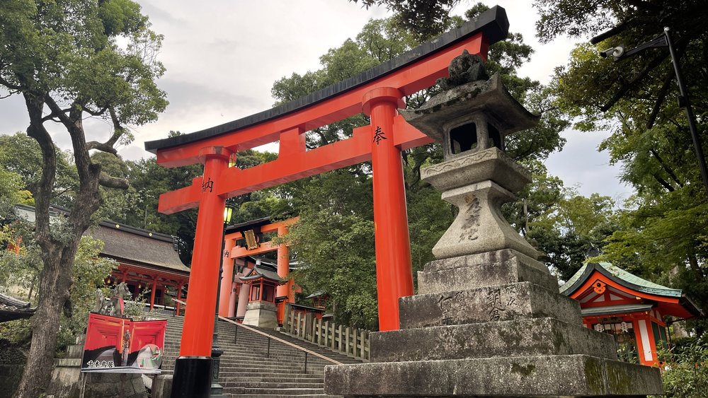
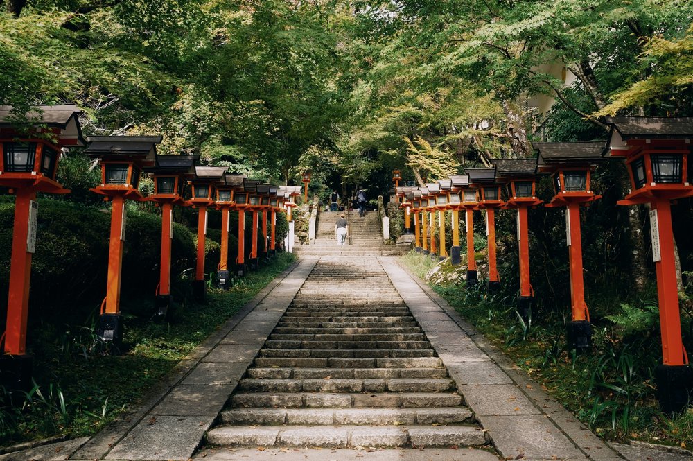
Fushimi Inari Taisha is the one hike almost every traveler ends up doing, usually without realising it's a hike. The senbon torii, the tunnels of vermilion gates, climb the slope of 233m Mount Inari, and the full loop to the summit and back runs 4–5km and takes 2–3 hours.
You don't have to complete the full hike. The Yotsutsuji viewpoint is 30–40 minutes up, and the panorama over southern Kyoto from there is better than the view at the actual summit, which is covered in trees. Plenty of travelers turn around at Yotsutsuji and feel no regret about it.
Getting there is easy. JR Inari Station is a 9-minute ride from Kyoto Station on the Nara Line and puts you right at the main torii gate. If you'd rather have someone show you the quieter side paths, the
Fushimi Inari hidden hiking tour takes you off the main gate route.
The Philosopher's Path
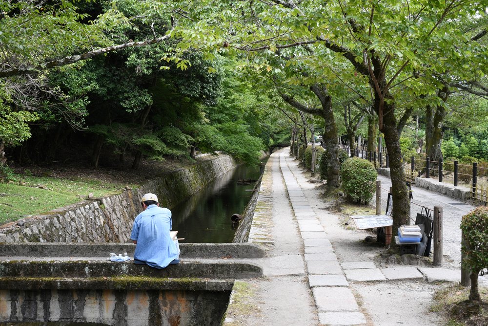
Tetsugaku-no-Michi, the Philosopher's Path, is 2km of flat canal-side walking between Ginkaku-ji and Nanzen-ji in Higashiyama. It takes about 30–40 minutes if you keep moving, longer in cherry blossom season when the whole city seems to be on it.
It's not a hike in any strict sense. But it links two major temples, it's genuinely lovely, and it pairs well with Daimonji-yama, the trailhead for that climb is at the Ginkaku-ji end of the same path.
Yoshida-yama
Yoshida-yama is the smallest hill on this list, it rises only about 100m, and the walk up takes 30 to 60 minutes. It sits between Ginkaku-ji, Yoshida Shrine and Kyoto University, so you can fold it into an afternoon you were already spending in that part of the city. You'll see cherry blossoms in spring and maples in autumn.
Arashiyama
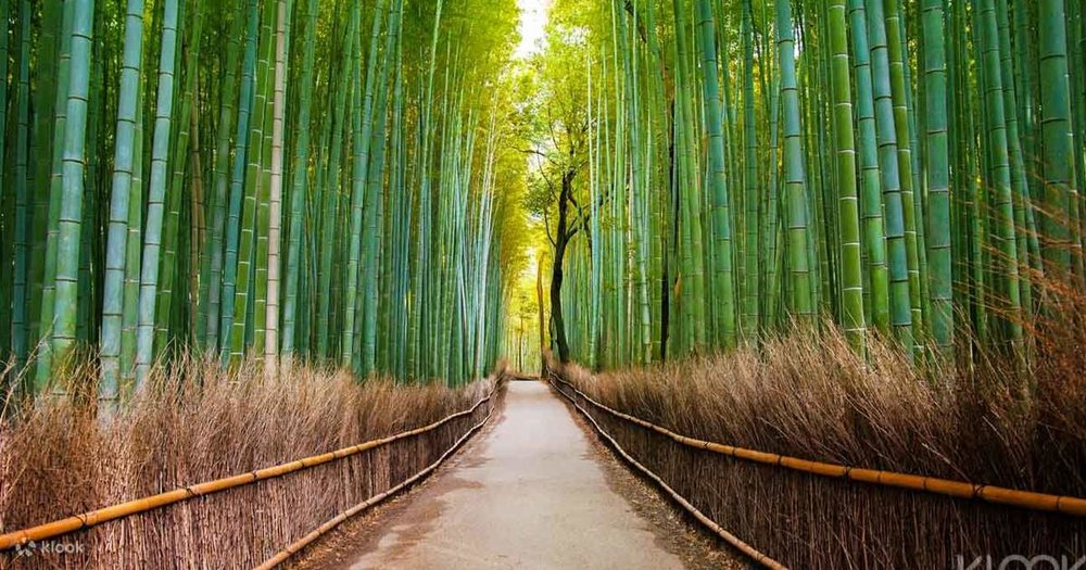
Arashiyama gives you a gentler version of the same idea. Start near Togetsukyo Bridge and you can walk up towards Mount Ogura for autumn leaf views, or just do the bamboo grove and the riverside. The grove gets very busy by mid-morning, so an
early morning small-group walk is the difference between photos and crowds.
Half-day hikes In Kyoto
Kurama to Kibune
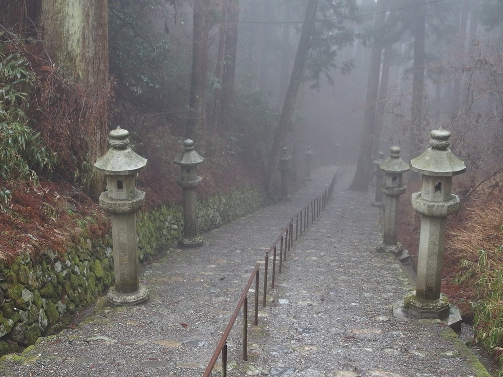
This is the best half-day hike near Kyoto, and it's easier than it looks. The route runs 3.9km from Kurama village over the ridge to Kibune, takes 2–3 hours, and is rated easy. You climb through Kurama-dera temple, past the Kinone Sando, a stretch where tree roots cover the path like veins, and drop down into Kibune on the other side.
Take the Eizan Line from Demachiyanagi Station and ride it to the last stop, Kurama; it's a 30-minute trip. Admission to Kurama-dera is ¥500. At the Kibune end, it's a 2km walk down the road to Kibune-guchi Station for the train back.
⚠️
Klook Tip: Finish the Kurama to Kibune hike at the onsen. A
Kurama and Kurama Onsen trip turns a two-hour hike into a proper reset, and in summer the riverside restaurants in Kibune serve meals on platforms suspended over the water.
Daimonji-yama
Daimonji-yama is the best short climb in Kyoto: 466m, roughly 3–4km round trip, 1.5–2 hours. The trailhead is right next to Ginkaku-ji, and the vertical rise from the temple's main gate to the viewpoint is about 220m.
Most people stop at the viewpoint, which you reach in about 40 minutes. If you have another 15 minutes in you, carry on to the actual peak. The mountain is the one carved with the giant character 大, lit up every August during the Gozan no Okuribi fire festival. Late afternoon is the popular slot, hikers gather at the viewpoint for sunset over the city.
Full-day mountain hikes
Now the proper ones. Start early, bring water, and check the weather before you commit.
Mount Hiei and Enryaku-ji
Mount Hiei rises to 848m on the border between Kyoto and Shiga, and the temple complex at the top, Enryaku-ji, founded in the 8th century, is a UNESCO-listed site with over a thousand years of history behind it. You can hike up in about three hours from Shugakuin Station, or follow a 6.7km section of the Kyoto Isshu Trail, an old pilgrimage route that takes roughly three hours.
If you'd rather save your legs one way, the Eizan Cable Car from Yase is a 15-minute ride and the steepest in Japan, connecting to a ropeway for the summit. A good compromise: hike up the Kyoto side, visit Enryaku-ji, then take the Sakamoto cable car down the Shiga side towards Lake Biwa.
⚠️ Important Note: The Eizan cable car and ropeway do not run from early December to mid-March. If you go in winter, you’ll have to hike both directions.
Takao to Kiyotaki
Takao is a village in the Kitayama mountains northwest of the city, home to three excellent temples: Jingo-ji, Saimyo-ji and Kozan-ji. The walk from Takao down along the Kiyotaki River takes 2–4 hours depending on your route, and it's one of the best fall foliage hikes anywhere near Kyoto.
Take the JR Bus from Kyoto Station to the Yamashiro-Takao stop, about 50 minutes, ¥530 one way, and covered by the JR Pass. From Kiyotaki at the other end, bus #62 runs to Sanjo Keihan and #72 to Kyoto Station, both via Arashiyama.
Mount Atago
Mount Atago is the hardest hike on this list and the highest mountain around Kyoto at 924m. Budget 4–6 hours round trip. The trail starts in the small village of Kiyotaki, and there's a shrine at the summit.
This is the one to start early for. Facilities thin out fast once you're on the trail, so carry your own water and food, and don't plan it as an afternoon activity.
When to hike in Kyoto and what to bring
The best months for hiking in Kyoto are March to May and September to November. Spring gives you cherry blossoms and fresh green on the lower slopes; autumn gives you the maples, which is why Takao and Kurama get busy in November. Summer is hot and humid enough to make even the easy trails hard work, and winter brings occasional snow at altitude.
A short packing list:
Hiking shoes with real grip, as the mountain trails have loose sections and tree roots.
More water and snacks than you think you need. Vending machines mostly stop at the trailhead.
Cash. Small shops and machines near trailheads often do not take cards.
Layers. It runs noticeably cooler on the mountains than in central Kyoto.
A weather check that morning, especially in summer and winter when conditions shift fast.
And one thing that isn't gear: these are active religious sites. Stay on the marked paths and follow the posted etiquette at temples and shrines along the way.
Guided hikes and how to book
You don't need a guide for any of these trails. Signage is decent and the popular routes are busy enough that you won't get lost. But a guide is worth it in two situations: when you want the history behind what you're walking through, and when you want to hike the parts of a trail that aren't on the main route.
Fushimi Inari is the clearest example. A
Fushimi Inari Taisha walking tour explains what the torii gates actually mean and who paid for them, which changes how the climb feels. For the mountain hikes, going with someone who knows the trail takes the guesswork out of route-finding and timing.
Guided Kyoto hikes book up in cherry blossom and autumn foliage season, so lock those in before you go rather than on the day.
Frequently Asked Questions
What is the best hike in Kyoto?
For most visitors, Kurama to Kibune is the best hike in Kyoto — 3.9km, 2–3 hours, rated easy, and it ends in a village with hot springs and riverside restaurants. If you only have a couple of hours, Daimonji-yama gives you the best city view for the least effort. And if you want the most iconic walk, it's Fushimi Inari up Mount Inari.
How long does it take to hike Fushimi Inari?
The full loop to the summit of Mount Inari and back takes 2–3 hours and covers roughly 4–5km. Most visitors do a shorter version: the Yotsutsuji viewpoint is 30–40 minutes from the base and has the best panorama on the mountain, so turning around there is a perfectly good option.
Is the Fushimi Inari hike difficult?
It's easy to moderate. There's no scrambling and no technical ground — the challenge is that much of the route is stairs, and it's a steady climb rather than a flat walk. If you can manage a few flights of stairs without stopping, you can do the first half. Trainers are fine.
What is the best trail for beginners in Kyoto?
Kurama to Kibune is the best beginner hike — it's rated easy, well signposted, and only 3.9km. If you want something even gentler, Yoshida-yama takes 30–60 minutes and rises about 100m, and the Philosopher's Path is completely flat over its 2km.
Can you hike Mount Hiei from Kyoto?
Yes. You can reach the 848m summit in about three hours on foot from Shugakuin Station, or follow a 6.7km section of the Kyoto Isshu Trail. The Eizan Cable Car from Yase is the shortcut, but note it does not operate from early December to mid-March.
What is the best time of year to hike in Kyoto?
March to May and September to November. Those windows give you mild temperatures plus the cherry blossoms in spring and maple colour in autumn. Summer is hot and humid, and winter can bring snow to the higher trails and closes the Mount Hiei cable car.
Are there guided hiking tours available in Kyoto?
Related Articles:
What is Klook?
Klook is a leading pan-regional experiences platform in Asia Pacific, purpose built to digitalize experiences and make them accessible to every traveler.
Our mission is to build the digital infrastructure for the global experience economy — empowering merchants to share their passions and travelers to discover the heartbeat of each destination. We operate a mobile-first, curated platform featuring diverse experiences across global destinations.