Xinjiang Ili Kalajun Small Ring Road 45KM light hiking for 4 days (Leader Association 1:8 high quota + 2 nights grassland camping plan + drone aerial photography or SLR random arrangement + Tekes Bagua City + Tarim Valley)
Kalajun Prairie


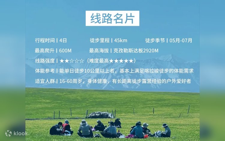

- [Hiking Difficulty 2 Stars] The hiking mileage is 45km, the maximum climb is 600M, the highest altitude is 2920M on the Kizilest Board, and those who can hike more than 10 kilometers in a single day basically meet the physical needs of the Kalajun hike.
- [Team leaders are equipped according to a high ratio of 1:8] Full-time professional outdoor team leaders, certified professional outdoor skills training by the China Mountaineering Association, and Chinese Red Cross first aid training to protect your travel safety
- [4 days and 2 nights grassland camping plan] Sleep under the stars in the grassland with the midsummer evening breeze, and have a conversation with the stars in the sky and the Milky Way
- [Travel through the historical city - Bagua City] More than two ethnic groups once thrived here, and you can feel the rich local folk customs and rich history and culture.
- [Photography Walking Tour] Drones and SLRs are randomly arranged and cannot be specified.
- [Logistics services are arranged] Provide camp fruit, tea break tent, camp meals, etc.
Contattaci
Hai una domanda su questa attività? Chiedici pure in live chat!